Midhurst
Midhurst sits in the western Weald of West Sussex, roughly 12 miles north of Chichester, where the Rother valley meets the foot of the South Downs.
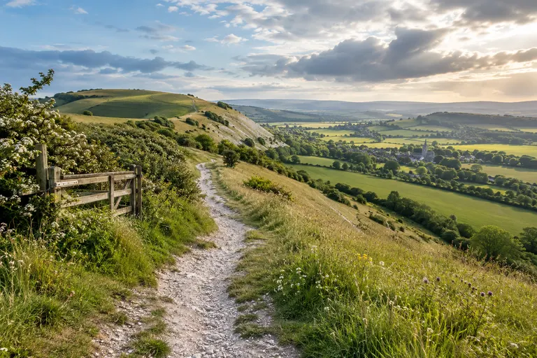
Midhurst sits in the western Weald of West Sussex, roughly 12 miles north of Chichester, where the Rother valley meets the foot of the South Downs. For most visitors, the town works best as a base: it has a compact historic centre, the ruined Tudor palace of the Cowdray Estate, and direct access to some of the most walkable downland in the county. It is not a large town, and it is not a resort. It is a small market town with a strong identity, a useful transport hub for the western Downs, and a sensible place to start a day out rather than the destination itself.
How to get there
The town sits roughly 12 miles north of Chichester, 20 miles north of the coast at Worthing, and about 15 miles south-west of Horsham. The A272 runs east, west through the settlement, linking it to Petworth and Pulborough to the east and Petersfield (in Hampshire) to the west. The A286 connects south to Chichester and north to Haslemere.
By train and connecting bus
There is no railway station in Midhurst. The nearest stations with regular services are Haslemere (about 7 miles north) and Chichester (about 12 miles south). National Rail advises checking train times before travel, as Sunday services on some branch lines are reduced.
From Haslemere, take the 92 bus via Fernhurst. From Chichester, take the 60 or 60A services via Singleton and Cocking; these pass near the Weald and Downland Living Museum. Bus times change seasonally, so check the Stagecoach South and West Sussex County Council travel pages on the day. The 92 service also links the town to Petworth and Pulborough railway station, where Southern trains run to London Victoria and Portsmouth. National Rail’s journey planner and the bus operator’s timetable are the authoritative sources for times and any temporary changes.
By car and where to park
Driving: the town is on the A272, roughly 12 miles north of Chichester and 10 miles east of Petersfield. Parking is limited in the centre. Use the North Street car park and the long-stay car park near the A272, and expect both to fill by mid-morning on fine weekends.
The Cowdray Estate and the ruined palace
The town’s most distinctive landmark is the ruined Tudor palace, gutted by fire in 1793. The shell is Grade I listed, sits beside the River Rother, and is now managed by a charitable trust. The ruins are open for exterior viewing at advertised times, with the estate operating the surrounding parkland and events. Check the official website for opening dates and access before you travel; the programme changes year to year.
The wider estate also runs the Cowdray Park Polo Club and a golf course, and includes woodland walks. The site has a long association with the Viscounts Cowdray, but the original Tudor house was largely destroyed by the 1793 fire. The ruin sits close to the town centre, so it is easy to visit on foot.
Historic streets and town layout
The high street runs north, south, with a mix of independent shops, cafes, and pubs. The town is compact, and the ruined house is a short walk from the centre. The older buildings cluster around the market square and the church of St Mary Magdalene. The streets north of the square are quieter and more residential. Several timber-framed buildings survive, and there is an antique market.
Walking routes and the Downs
The town is at the western edge of the South Downs National Park, with the Downs rising immediately to the south and the Weald to the north. The South Downs Way passes nearby at Cocking. The Serpent Trail, a long-distance walking route, starts at Haslemere and passes through the Cowdray Estate before heading to Petersfield. The West Sussex Literary Trail links the town to the poet Wilfrid Scawen Blunt, who lived at Newbuildings Place, and to H.G. Wells, who was apprenticed in the town. The Midhurst Way is a waymarked circular walk of about 18 miles (29 km) around the town, starting and finishing at the historic centre. The Downs Link bridleway, a 37-mile route from Guildford to Shoreham-by-Sea, passes close by and connects the town to the Downs and the coast.
What to do: a half-day plan
- Arrive by mid-morning. Park at North Street car park or the long-stay car park near the A272. On fine weekends, both fill early.
- Walk to the ruined palace. The shell is a short walk from the centre. Confirm opening times on the estate website before you set out.
- Explore the high street. Walk north, south through the market square. Stop at an independent cafe or the antique market.
- Pick a walking route. If you have three hours or more, join the South Downs Way at Cocking, follow a section of the Serpent Trail through the estate, or walk a loop of the Midhurst Way.
- Use the bus for a car-free day. From Chichester, take the 60 or 60A; from Haslemere, take the 92. Check return times before you leave, because Sunday services are infrequent.
Bus and rail context at a glance
- Haslemere station (about 7 miles north): 92 bus.
- Chichester station (about12 miles south): 60 and 60A buses via Singleton and Cocking.
- Petersfield station (about7 miles west, Hampshire): connecting bus services.
- Pulborough station (via the 92): Southern trains to London Victoria and Portsmouth.
All services are operated by Stagecoach South (2024-25 timetable). Timetables change seasonally; confirm times with the operator before travelling.
Where the town fits
The settlement sits in West Sussex, within the South Downs National Park, at a crossing of the River Rother between the western Rother valley and the foot of the Downs. It is roughly 12 miles north of Chichester, 18 miles south-west of Horsham, and about 13 miles south-east of Petersfield. The A272 and A286 meet here. The Cowdray Estate surrounds the town and is the major private landowner. The town is a practical base for walking the downs, visiting the Weald and Downland Living Museum, and exploring the Singleton and Charlton area.
Read next
-
Chichester
Chichester is the historic heart of West Sussex, a city with Roman roots and a compact centre that is easy to explore on foot.
-
Petworth
Petworth is a small market town in West Sussex, roughly halfway between Chichester and Midhurst, set at the western edge of the South Downs National Park.
-
Arundel
Arundel sits in the Arun Valley on the western edge of the South Downs National Park, roughly halfway between Chichester and Worthing.
-
Bognor Regis
Bognor Regis is a seaside town on the West Sussex coastal plain, roughly 10 miles south-east of Chichester and about 20 miles west of Worthing.
-
Crawley
Crawley is West Sussex’s largest town, a postwar New Town that grew around a medieval market core, and the place most visitors to the county pass through without stopping.
-
East Grinstead
East Grinstead sits in the far north-east of West Sussex, close to the Surrey and Kent borders, and is the county’s easternmost town of any size.