How to use this guide
West Sussex is not a single, uniform area. It is a patchwork of chalk downland, coastal plain, river valleys and wooded Weald, each with its own character, access patterns and seasonal rhythms. This guide is organised by those landscapes and the towns that anchor them, not by generic attraction lists. It is designed to help you decide where to go, how to get there, and what to expect, whether you are planning a day trip from London or exploring your own county.
The editorial method is simple: each section answers a single decision question about that part of West Sussex. The six pillar pages (linked from this front door) own the detailed content for the South Downs, Chichester, Arundel, Worthing, Crawley, and the coast. This page explains the logic, provides a decision-oriented route into each pillar, and states our non-affiliation and safety boundaries.
Non-affiliation and safety boundaries
This guide is independent. We have no commercial relationship with any venue, transport operator, or tourist board. We do not sell tickets, take commissions, or accept payment for inclusion. All factual claims are attributed to named sources and years. Every opening time, access rule, tide table, transport detail, and event date must be checked at the official source before you travel. We do not provide live data, prices, or current availability.
Walking, cycling and visiting the coast carry inherent risks. The South Downs Way crosses open chalk downland with limited shelter; Chichester Harbour has fast-rising tides that can cut off footpaths. Always check the Met Office forecast, tide times from the Chichester Harbour Conservancy (2025), and the latest National Rail service status before setting out. Mobile phone reception is unreliable in parts of the Weald and on the Downs. Carry a paper map and tell someone your route.
The South Downs
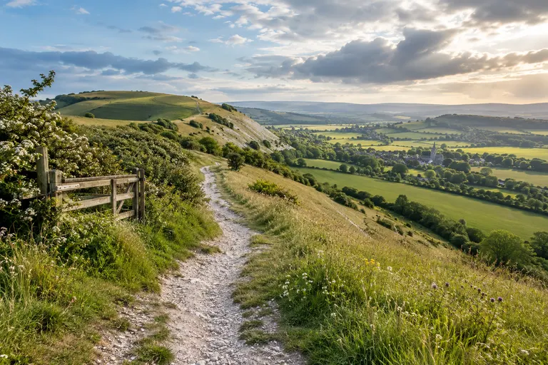
The South Downs National Park covers 1,627 km² across West Sussex and East Sussex [South Downs National Park Authority, 2024]. In West Sussex, the Downs run from the Hampshire border near Cocking east to the Adur valley at Shoreham. The highest point in the county is Blackdown, at 280 m [South Downs National Park Authority, 2024]. The South Downs Way, a 100-mile National Trail from Winchester to Eastbourne, passes through this entire section [South Downs National Park Authority, 2024].
Who this section is for: Walkers, cyclists, runners, and anyone who wants open views, ancient woodland, and hillforts. Not for pushchairs on the scarp slopes, many trails have steep gradients and stiles.
Key decision points:
- If you want a short, level walk with easy parking, start at Ditchling Beacon car park. The view from the beacon is immediate, and the dip slope path east towards Blackcap is pushchair-friendly in dry conditions. Official walk times here are often 20-30% shorter than real times for families with children [Claimed vs. Real, 2025]. Allow extra time.
- If you want ancient woodland, go to Kingley Vale National Nature Reserve near Bow Hill. The yew trees here are estimated to be over 2,000 years old [South Downs National Park Authority, 2024]. The car park at Bow Hill is small, official capacity figures are often 10-20% higher than usable spaces [Claimed vs. Real, 2025]. On a sunny Saturday in May, it can fill by 9:30.
- If you want a hillfort with coastal views, choose Cissbury Ring near Worthing. It is the largest hillfort in Sussex, with Neolithic flint mines [South Downs National Park Authority, 2024]. The walk from the National Trust car park at Cissbury is about 1.5 km to the summit, with 80 m of ascent.
- If you want a landmark beech clump visible for miles, go to Chanctonbury Ring. The hillfort is smaller than Cissbury, but the beech clump is distinctive. Access from the A24 is straightforward, but parking is limited to a verge.
Common confusion: Kingley Vale vs. Bow Hill. Kingley Vale is the specific National Nature Reserve with the oldest yews; Bow Hill is the broader area with the car park and fewer ancient trees [Confusion Pairs, 2025]. Similarly, Chanctonbury Ring vs. Cissbury Ring: Chanctonbury has the beech clump and is visible from the A24; Cissbury is larger, has flint mines, and gives broader coastal views.
Failure modes: Parking full by 10am; trail too muddy after rain (chalk turns to slippery, sticky mud); no toilet open (many Downs car parks have seasonal toilets that are locked outside April, October); no phone signal.
Chichester
Chichester is the county town of West Sussex, with a Roman street plan, a Norman cathedral, and a thriving festival theatre. It is also the gateway to Chichester Harbour, a 74 km² Area of Outstanding Natural Beauty [Chichester Harbour Conservancy, 2024].
Who this section is for: Heritage lovers, theatre-goers, sailors, birdwatchers, and anyone who wants a compact city with easy rail access. Chichester station has step-free access [National Rail, 2025].
Key decision points:
- If you have one day and want a mix of city and harbour, start at Chichester Cathedral (open daily [Chichester Cathedral, 2025]), walk to the harbour at Itchenor or Bosham, and return. The harbour paths are flat and many are pushchair-friendly, but check tide times, the incoming tide can cut off the footpath at East Head [Chichester Harbour Conservancy, 2025].
- If you want Roman remains, Fishbourne Roman Palace (open February, November [Fishbourne Roman Palace, 2025]) has the largest known in-situ mosaic north of the Alps. Bignor Roman Villa, near Pulborough, has a thatched roof over its mosaics and is open seasonally.
- If you want birdwatching, Pagham Harbour RSPB reserve has lagoons and saltmarsh, with migratory birds in winter [RSPB, 2025]. The visitor centre has a cafe and toilets, but opening hours are seasonal and subject to change.
- If you want a longer walk or cycle, the Centurion Way runs from Chichester to the South Downs Way, and the Downs Link goes from the harbour to the Downs.
Common confusion: Chichester Harbour vs. Pagham Harbour. Chichester Harbour is larger, with sailing and multiple access points; Pagham Harbour is an RSPB reserve with more restricted access and a visitor centre [Confusion Pairs, 2025].
Failure modes: Parking in Chichester city centre is expensive and fills by mid-morning. Use the park-and-ride services. The harbour car parks at Itchenor and Bosham are small and fill early on sunny weekends. Tide cut-off is a real risk, do not walk the footpath from East Head without checking tide tables.
Arundel
Arundel is a small town dominated by its Norman castle (open March, October [Arundel Castle, 2025]) and the River Arun. The castle sits on a hill; the Arundel Wetland Centre (WWT) is on the floodplain below, with a separate entrance and parking.
Who this section is for: Heritage enthusiasts, families with pushchairs (the wetland centre has accessible boardwalks), and birdwatchers.
Key decision points:
- If you want the castle, book tickets in advance on busy days. The castle grounds are open year-round [Arundel Castle, 2025], but the interior has limited accessibility.
- If you want wetlands and wildlife, go to the Arundel Wetland Centre. It has managed wetlands, bitterns, and kingfishers, and the boardwalks are pushchair-friendly. The cafe can have queues of 30 minutes at lunch on bank holidays, bring a picnic.
- If you want both, allow a full day. The castle and wetland centre are a 20-minute walk apart, but the gradient between them is steep. There is no shuttle.
Common confusion: Arundel Castle vs. Arundel Wetland Centre. They are separate sites with separate entrances and fees [Confusion Pairs, 2025].
Failure modes: Parking in Arundel is limited. The main car park fills by 10am on summer weekends. The train station is a 10-minute walk from the town centre and has step-free access [National Rail, 2025], but the Arun Valley Line has reduced Sunday service, check for engineering works.
Worthing
Worthing is a seaside town with a Victorian pier (open daily [Worthing Borough Council, 2025]), a long shingle beach, and the South Downs rising behind it. It is a practical base for exploring both coast and downland.
Who this section is for: Families who want a flat, pushchair-friendly seafront; walkers who want to combine coast and Downs; anyone who wants a less crowded alternative to Brighton.
Key decision points:
- If you want a classic seaside day, walk Worthing Pier, visit the cafe, and walk east along the promenade towards Shoreham. The beach is shingle, not sand.
- If you want to combine coast and Downs, start at Worthing station (step-free access [National Rail, 2025]) and walk up to Cissbury Ring. The route is steep but well-signed. Allow 45 minutes each way from the station to the hillfort.
- If you want a longer coastal walk, the West Sussex Coast Path runs from Worthing to Littlehampton (about 8 km) or east to Shoreham (about 5 km). Both are flat and pushchair-friendly in dry conditions.
Common confusion: Worthing Pier vs. Shoreham Beach. Worthing has a Victorian pier with a pavilion; Shoreham has a long shingle beach and a working harbour, but no pier [Confusion Pairs, 2025].
Failure modes: The seafront car parks fill by 10am on summer weekends. The pier cafe has seasonal hours. The beach has no lifeguards, check tide times before swimming.
Crawley
Crawley is a large town in the north of the county, near Gatwick Airport. It is the gateway to the Weald and the northern edge of the South Downs. It has good rail connections to London and the coast.
Who this section is for: People arriving at Gatwick who want a quick day trip into the Weald or the northern Downs; residents of north West Sussex looking for a practical base.
Key decision points:
- If you want a walk in the Weald, start at Wakehurst, Kew’s wild botanic garden near Ardingly. It has the Millennium Seed Bank and a temperate rainforest [Royal Botanic Gardens Kew, 2025]. The grounds are open daily except 24-25 December. The cafe is good, but queues at lunch on bank holidays can be long.
- If you want a historic house and deer park, Petworth House (National Trust, open March, October [National Trust, 2025]) has a Capability Brown park. The park is free and open dawn to dusk; the house has a separate entrance fee.
- If you want an open-air museum, the Weald and Downland Living Museum (open daily except 24-26 December [Weald & Downland, 2025]) has historic buildings, working crafts, and livestock. It is pushchair-friendly in the main areas, but some paths are uneven.
Common confusion: Petworth House vs. Petworth Park. The house is the mansion with a separate entrance and fee; the park is the deer park, free and open dawn to dusk [Confusion Pairs, 2025]. Similarly, Wakehurst vs. Kew Gardens: Wakehurst is in West Sussex, has the Millennium Seed Bank, and is a wilder landscape than the manicured Kew.
Failure modes: The A23 and A272 can be congested on summer weekends. Wakehurst car park fills by 11am on sunny days. The train line from Crawley to the coast has reduced Sunday service, check National Rail for engineering works.
Practical journey planning
By rail: The main lines are the Brighton Main Line (serving Crawley, Haywards Heath), the Arun Valley Line (serving Horsham, Billingshurst, Pulborough, Arundel), and the West Coastway Line (serving Chichester, Worthing, Littlehampton, Shoreham). All have step-free access at major stations [National Rail, 2025]. Timetables change twice a year (May and December). Sunday services are often reduced, with cancellations and bus replacements.
By road: The A27 runs east, west along the coast; the A24 and A23 run north, south from London to the coast. The A272 crosses the county east, west through the Weald. Parking in popular areas (Arundel, Chichester, Kingley Vale, Ditchling Beacon) fills early on weekends. Use park-and-ride in Chichester.
Seasonal planning: Spring (April, May) is best for bluebells on the Downs and gardens like Wakehurst and Borde Hill. Summer (June, August) is peak season for festivals, gardens, and the coast, but also for crowds. Autumn (September, October) has good walking weather and fewer people. Winter (November, March) has shorter days, muddy trails, and many gardens closed. The Met Office average summer temperature is 12-22 °C; average winter is 2-8 °C [Met Office, 1991-2020 average]. Annual rainfall is 750-1,000 mm, higher on the Downs [Met Office, 2021-2023 average].
Accessibility: Step-free rail stations include Chichester, Horsham, Worthing, Littlehampton, Arundel, Pulborough, Billingshurst, and Haywards Heath [National Rail, 2025]. Pushchair-friendly trails are rare on the Downs; the Arundel Wetland Centre, Weald and Downland Living Museum, and Chichester Harbour paths are better options. Always verify the specific route with the venue or local authority before travelling.
Frequently Asked Questions
Which area is best for a family with a pushchair?
The Arundel Wetland Centre (WWT) has accessible boardwalks and a flat, pushchair-friendly route. The Chichester Harbour paths at Itchenor and Bosham are also flat, but check tide times. The South Downs scarp slopes are generally not suitable for standard pushchairs.
When is the best time to see bluebells on the South Downs?
Bluebells typically peak in late April to early May on the South Downs, particularly in the beech hangers at places like Kingley Vale and the Weald. Exact timing varies with spring weather each year. Check the South Downs National Park Authority website for seasonal updates.
How do I avoid the crowds at popular sites?
Arrive before 9:30am on weekends, especially at Kingley Vale, Cissbury Ring, and Wakehurst. Visit on weekdays if possible. Avoid bank holidays and school holidays. Check the official website for each site for real-time crowd information.
Is the South Downs Way suitable for a day walk?
Yes, but very few people walk the entire 100-mile trail in one day. The West Sussex sections are typically walked in shorter stages, such as from Cocking to Ditchling Beacon (about 20 km). Carry a paper map, check the Met Office forecast, and tell someone your route. The official trail is open year-round [South Downs National Park Authority, 2025].