Horsham
Horsham is the administrative centre of West Sussex County Council, yet it feels less like a county town and more like a market town that happens to have a district council, a hospital…
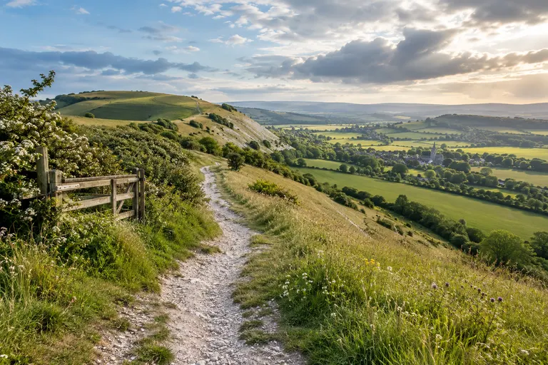
Horsham is the administrative centre of West Sussex County Council, yet it feels less like a county town and more like a market town that happens to have a district council, a hospital, and a railway line. It sits on the northern edge of the western Weald, roughly 30 miles south of London, with Crawley to the north-east and the South Downs beginning about 12 miles to the south. For visitors, Horsham is the most practical base for exploring the western half of West Sussex: it has a compact centre of old streets, a large park, and direct rail links to London, Chichester, and the coast. The town gives you quick access to the western Weald and the northern edge of the Downs without being inside the national park or on the coastal strip.
The old core and the Causeway
The Causeway is the spine of old Horsham. It runs south from the parish church of St Mary the Virgin towards the river, and it is the single most useful street to know. The name comes from the raised, paved route that connected the town centre to the church and the river crossing. Today it is a short, mostly pedestrian-friendly street of timber-framed and tile-hung buildings, many of them listed. A walk along it gives you the town’s oldest character in a few hundred metres, and it links the modern shopping centre to the Carfax, the old market square.
The Carfax is the old heart. The Horsham District Council website describes the area as the old market place, and the weekly market still operates there on Saturdays; check the council’s own pages for current market days and times. The town’s name is usually explained as “horse enclosure” or “horse meadow,” and the market charter dates from 1233, granted by Henry III, according to Horsham District Council’s heritage notes. The name is first recorded in the Domesday Book of 1086, and the area was a royal manor in the Middle Ages.
The wider town centre is a mix of medieval lanes, Victorian shopfronts, and post-war development. The main shopping streets run between the Carfax and the Swan Walk shopping centre. Swan Walk and the older West Street and East Street together form the core retail area. The Carfax itself is the old market square, with the bandstand and the statue of Shelley, the poet, who was born at Warnham nearby in 1792.
The Causeway in detail
The Causeway is a narrow street of 17th- and 18th-century houses leading south from the Carfax, and it is the most complete old street in the town. It is home to the Horsham Museum and a series of timber-framed and tile-hung buildings. The street itself is a conservation area and a good starting point for a walk that takes in the town centre, the parish church of St Mary the Virgin, and the River Arun.
Horsham Museum, run by Horsham District Council, is inside the old town hall on the Causeway. It is housed in Causeway House, a 16th-century building, and holds collections on local history, natural history, the town’s role as a centre of the iron industry, its connections to the Shelley family, its part in the Second World War, and a famous collection of horse brasses. It is a free local museum.
The parish church of St Mary the Virgin, at the south end of the Causeway, is the town’s oldest surviving building, with a 13th-century tower and later restorations.
The modern town and its landmarks
The town centre is compact and walkable, with the Carfax as the main square and the pedestrianised high street running south. The Swan Walk and Piries Place shopping areas are the main retail hubs; the latter sits within the former site of the town’s cattle market. The Capitol is the town’s main arts venue, with cinema, theatre, and live events.
Horsham Park lies south of the centre, a large open space with a boating lake, play areas, and sports pitches. The park is the site of the former Horsham Park House, and it remains the town’s main green lung.
The town grew as a market centre for the surrounding Weald, and later as a commuter town after the railway arrived in the 1840s. The modern town centre mixes old buildings, independent shops, and chain stores, with the main shopping streets radiating from the Carfax.
Position and connections
Horsham’s position matters. It sits at the western edge of the High Weald, on the River Arun, and is the administrative centre of West Sussex County Council. It is not on the coast and not in the South Downs National Park, but it is the practical launch point for the western Weald and the northern edge of the Downs. The South Downs Way crosses the county from west to east; Horsham is not on the trail but is within a short drive of the Downs around Washington and Storrington. Crawley, with Gatwick Airport, lies to the north-east, and the A24 links Horsham to Worthing and the coast. Trains from London Victoria reach Horsham in about 55 minutes (National Rail, 2024).
The River Arun rises near the town and flows south to the sea at Littlehampton. The old town centre clusters around the Causeway, a tree-lined pedestrian street that connects the parish church of St Mary’s to the Carfax. Horsham’s weekly market and the surrounding pedestrianised streets give it the feel of a market town, even though the modern retail core now extends to Swan Walk and the West End.
The wider Horsham District
The Horsham District is the largest district in West Sussex by area, covering a broad band of the Low Weald and the western edge of the High Weald. It includes the market towns of Horsham, Billingshurst, Pulborough, and Steyning, and the villages of Henfield, Storrington, and Ashington. The district boundary runs from the Surrey border near Crawley in the east to the River Arun in the west, and from the A272 in the south to the A264 in the north. It does not include Crawley itself, which is a separate borough in West Sussex, nor does it include the coastal towns of Worthing, Littlehampton, or Bognor Regis, which sit on the coastal plain to the south. The South Downs National Park boundary clips the southern edge of the district, taking in the scarp slope of the Downs around Amberley, Washington, and Steyning. The western Weald, a landscape of woods, heath, and sandstone ridges, lies to the south and west of Horsham town.
Market towns and villages
The district’s other market towns each have a distinct role. Billingshurst sits on the A29 and serves the western Weald villages. Pulborough straddles the River Arun and gives access to the RSPB reserve at Wiggonholt and the South Downs Way above Amberley. Steyning is a small, old town tucked under the Downs, with a high street of independent shops and a direct walking route onto the scarp. Storrington lies further east along the A283, at the foot of the Downs, and works as a quieter base for walkers.
Getting around without a car
Getting here without a car works, as long as you plan around the one useful bus. The main rail line from London Victoria to Horsham continues to Barnham and Chichester, with connections to the coast. The bus network radiates from Horsham town centre, but frequencies drop sharply on Sundays and in the evenings. The Compass Bus 100 service links Horsham to Pulborough, Storrington, and Steyning roughly every hour on weekdays. Check current timetables before you rely on it for a day of walking on the Downs.
Using Horsham as a base
Horsham is the administrative and commercial centre of the district that bears its name. The town is set on the western edge of the High Weald, roughly 30 miles south of London, 20 miles north of Brighton, and 12 miles south-west of Gatwick Airport. For a visitor with a car, it works as a base for three distinct landscapes: the wooded Weald to the north and west, the open Downs to the south, and the coastal plain beyond. For a visitor without a car, the direct train to London and the coast, plus the bus to the Downland villages, make it the most connected inland town in West Sussex.
Read next
-
Steyning
Steyning sits at the foot of the South Downs, roughly halfway between Worthing and Horsham, and is one of West Sussex’s most complete historic towns.
-
Arundel
Arundel sits in the Arun Valley on the western edge of the South Downs National Park, roughly halfway between Chichester and Worthing.
-
Bognor Regis
Bognor Regis is a seaside town on the West Sussex coastal plain, roughly 10 miles south-east of Chichester and about 20 miles west of Worthing.
-
Chichester
Chichester is the historic heart of West Sussex, a city with Roman roots and a compact centre that is easy to explore on foot.
-
Crawley
Crawley is West Sussex’s largest town, a postwar New Town that grew around a medieval market core, and the place most visitors to the county pass through without stopping.
-
East Grinstead
East Grinstead sits in the far north-east of West Sussex, close to the Surrey and Kent borders, and is the county’s easternmost town of any size.