Burgess Hill
Burgess Hill sits in the central Weald of West Sussex, about halfway between Brighton and Crawley, and is best understood as a practical base rather than a destination in its own right.
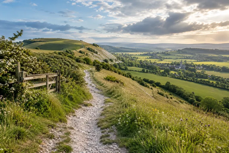
Burgess Hill sits in the central Weald of West Sussex, about halfway between Brighton and Crawley, and is best understood as a practical base rather than a destination in its own right. The town is a rail-connected commuter hub with direct Thameslink services to London Bridge and St Pancras, and it is the most convenient jumping-off point for exploring the northern edge of the South Downs, the nearby village of Ditchling, and the wider West Sussex countryside. For visitors, the town itself offers few grand sights, but its position makes it a useful staging post for a day out.
What kind of town is Burgess Hill?
Burgess Hill is a town and civil parish in the Mid Sussex district of West Sussex, around 8 miles north of Brighton. It is not a historic market town like Steyning or Midhurst, and it is not a seaside resort like Worthing; it is primarily a commuter and residential town that grew rapidly in the 20th century. The town sits on the northern edge of the South Downs National Park, with the scarp slope of the Downs rising immediately to the south. For visitors, the practical role of Burgess Hill is as a rail-connected base: direct trains run to London and Brighton, and the town gives quick access to the downland escarpment, the high point at Ditchling, and the villages along the foot of the Downs.
The town’s own attractions are modest: a small museum, a park, and a handful of cafés. Its value is as a base for exploring the western Weald, the northern edge of the South Downs, and the neighbouring villages of Ditchling, Hassocks, and Hurstpierpoint. The town is not a tourist destination in the same way as Chichester or Arundel, but it is a practical, well-connected place from which to explore the western Weald and the eastern South Downs.
How the town grew
Burgess Hill grew rapidly in the 19th and 20th centuries, partly because of brickmaking and the railway. That history still shows in the street pattern: a compact centre around the station, with residential streets spreading out to the north and east. Most of its housing dates from the 20th century. The civic heart is around the war memorial and the pedestrianised area near the station, and the town’s main shopping street is Church Road. The High Street runs north-south, with the railway station at the north end.
Where it sits in West Sussex
Burgess Hill is in the Mid Sussex district of West Sussex, about midway between Brighton and Crawley, and about 8 miles north of the coast at Shoreham-by-Sea. It sits on the edge of the Low Weald, with the South Downs rising to the south. The town is a rail-connected base for exploring the western Weald and the Downs, with direct trains to London, Brighton, and the Sussex coast. The county boundary with East Sussex is a few miles to the south-east; the closest city for shopping and nightlife is Brighton, which sits across that boundary. If you are planning a night out there, treat it as a separate journey and check the last train times before committing.
Getting there by rail
Burgess Hill railway station is on the Brighton Main Line, with services operated by Thameslink and Southern. Trains run frequently to London Bridge and London Victoria, with journey times around 50-60 minutes depending on the service. The station is about 500 metres from the town centre, making it a practical base for a car-free day. The line also connects to Brighton, Gatwick Airport, and Crawley, with changes at Haywards Heath or Three Bridges for destinations further north. Use the National Rail website or app for live departures, engineering works, and ticket prices; check before travelling.
The town has two railway stations: Burgess Hill on the Brighton Main Line, and Wivelsfield on the same line, slightly to the east. Both are managed by Southern, and both offer direct services to London Bridge, London Victoria, Brighton, and Gatwick Airport. For a day trip, the station is the natural anchor: the town centre is a short walk from Burgess Hill station, and the surrounding residential streets are flat and easy to navigate. If you arrive by car, the town sits close to the A23, which connects Brighton to the M23 and Crawley. Gatwick Airport is about 20 minutes away by train via Three Bridges or a short drive north on the A23.
Station access and step-free travel
The station has step-free access to the London-bound platform via a footbridge with lifts, but the Brighton-bound platform is reached by stairs in some configurations. The official station page on the National Rail site (checked 2025) lists the current access details. If you are travelling with a pushchair or heavy luggage, check that page before arrival and plan which entrance to use.
Timetable essentials
Journey times from London Victoria are around 55-60 minutes, and around 15-20 minutes from Brighton, but these are indicative. Always confirm the current timetable with National Rail before travel. The town has no direct station access to the South Downs Way. The nearest mainline station for the South Downs Way is Burgess Hill itself, with trains on the Brighton Main Line. The station is about 1 km from the town centre, which is walkable on level ground.
Using Burgess Hill as a base for the South Downs
What most visitors actually come for is not the town centre itself, but the access it gives to the surrounding landscape. Burgess Hill is not a tourist town; it is a commuter town with a decent rail service and a useful position between the South Downs and the Weald. The South Downs National Park, designated in 2010, runs along the southern edge of Burgess Hill. The South Downs Way passes through the park, and the nearest section is at Ditchling Beacon, about 5 miles south of the town. The South Downs National Park Authority (SDNPA) manages the park and provides visitor information on its official website. The park covers 1,600 square kilometres across East and West Sussex and Hampshire (South Downs National Park Authority, 2023). Burgess Hill is not inside the park, but its southern edge is the escarpment of the Downs, so the town works well as a base for walking, cycling, and exploring the downland villages.
Ditchling Beacon and the South Downs Way
Ditchling Beacon is the highest point on the South Downs Way in East Sussex, at 248 m, and sits about 5 miles south of Burgess Hill. The beacon is a popular viewpoint and a key access point for the South Downs Way. The nearest rail station to Ditchling Beacon is Plumpton, about 2.5 miles away, but the route from Burgess Hill involves a climb from the town centre. The South Downs Way passes over Ditchling Beacon, and the section from there to the town of Lewes is one of the most walked sections in the park (South Downs National Park Authority, 2024).
How to reach the downs from the town
To reach the escarpment from Burgess Hill station, walk or take a local bus south towards Ditchling. The climb onto the Downs begins in earnest once you leave the built-up area. Plan your route using the SDNPA website before setting out, and carry water and a map; the ascent is steady but exposed in places. If you prefer a gentler start, take the train one stop to Hassocks and walk from there to the foot of the Downs.
Read next
-
East Grinstead
East Grinstead sits in the far north-east of West Sussex, close to the Surrey and Kent borders, and is the county’s easternmost town of any size.
-
Haywards Heath
Haywards Heath is a central West Sussex market town with a fast rail link to London, making it a practical base for exploring the surrounding countryside, gardens and villages.
-
Arundel
Arundel sits in the Arun Valley on the western edge of the South Downs National Park, roughly halfway between Chichester and Worthing.
-
Bognor Regis
Bognor Regis is a seaside town on the West Sussex coastal plain, roughly 10 miles south-east of Chichester and about 20 miles west of Worthing.
-
Chichester
Chichester is the historic heart of West Sussex, a city with Roman roots and a compact centre that is easy to explore on foot.
-
Crawley
Crawley is West Sussex’s largest town, a postwar New Town that grew around a medieval market core, and the place most visitors to the county pass through without stopping.