East Grinstead
East Grinstead sits in the far north-east of West Sussex, close to the Surrey and Kent borders, and is the county’s easternmost town of any size.
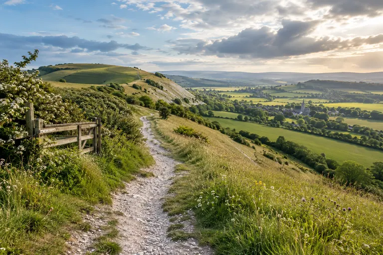
East Grinstead sits in the far north-east of West Sussex, close to the Surrey and Kent borders, and is the county’s easternmost town of any size. It is not a South Downs town: the chalk escarpment lies roughly ten miles to the south. The town belongs to the Weald, the older, wooded landscape of clay and sandstone that separates the Downs from the North Downs. For a visitor, the useful way to think of East Grinstead is as a gateway to the High Weald, to Ashdown Forest, and to the rail network that links it to London, Brighton and the Sussex coast. The deeper issue behind most visitor questions is not which single sight to see but how to join the town to the wider landscape: the High Street, the Weald, the forest and the rail line to London.
Where East Grinstead sits
East Grinstead is about 27 miles south of London, 13 miles east of Crawley and 15 miles north of Haywards Heath. The town is not in the South Downs National Park; the park boundary lies to the south. East Grinstead is a useful base for the western edge of the High Weald and the northern approach to Ashdown Forest. The nearest large centres are Crawley (about 9 miles west) and Horsham (about 12 miles west), with Gatwick Airport roughly 10 miles north-west.
Getting your bearings
The town’s medieval core is compact. The parish church of St Swithun stands near the top of the hill. The church dates from the 13th century, with later restorations, and its tower is visible from the High Street. The High Street itself runs roughly north-south and is the spine of the town centre. It is a mix of independent shops, cafes and services rather than a chain-heavy retail core. Parking is the main constraint on a visit: the town centre car parks fill early on market days and fine weekends. Check West Sussex County Council’s parking pages for live spaces and charges before setting out.
The historic High Street
East Grinstead’s High Street is one of the longest in Sussex and retains a mix of timber-framed buildings, 18th-century shopfronts and later brick fronts. The street is lined with independent shops, cafes and a small museum.
The Tudor House and what you can actually see
The most distinctive building is the early-15th-century timber-framed house at the junction of the High Street and Middle Row. The building is known locally as the “Tudor House” and is one of the few surviving examples of a Wealden hall house in the town. It is not open to the public on a regular basis; check the official town or heritage listings before planning a visit.
Railway heritage and the Bluebell Railway
East Grinstead is the northern terminus of the Bluebell Railway, the preserved standard-gauge line that runs south to Sheffield Park in East Sussex. The station is at the western end of the town centre, roughly 10 minutes on foot from the High Street. The Bluebell Railway is a separate heritage operation from National Rail services. The heritage line operates steam and diesel services on selected dates through the year; the Bluebell Railway’s own website publishes the running timetable and fare structure. The line’s northern terminus at East Grinstead has a reconstructed station, a small museum and a cafe, but opening hours and service dates change seasonally, so check the official Bluebell Railway site before planning a visit.
Mainline connections
The town’s main line station is served by Southern trains from London Victoria via Gatwick Airport and Three Bridges. The heritage service is adjacent to the mainline station but is not the same company. National Rail journey times and service changes should be checked on the National Rail website before travel.
Ashdown Forest and the Weald
East Grinstead sits at the western edge of Ashdown Forest, the High Weald Area of Outstanding Natural Beauty that inspired the Hundred Acre Wood in A.A. Milne’s Winnie-the-Pooh stories. The forest is not a single enclosed woodland but a large area of open heath and wooded hills, with public access across its commons. The Weald is a landscape of sandstone ridges, clay vales and ancient woodland, quite different from the chalk Downs to the south. The High Weald Area of Outstanding Natural Beauty covers much of the surrounding countryside, including parts of the Weald that are protected for their wooded, rolling character. The South Downs National Park begins south of the town, around Ditchling and the Ouse valley, and is reached via the A272 or A23 rather than directly from the town centre.
Practical access to the forest
From East Grinstead, the forest edge is roughly 5 to 8 miles south-east; allow 20 to 30 minutes by car depending on the access point. The Ashdown Forest Centre provides car parking, toilets and trail information. Check the official Ashdown Forest website for seasonal opening and parking charges. Ashdown Forest itself lies just across the county boundary in East Sussex; the main car parks are about 10 to 15 minutes by car from East Grinstead. It is managed by the Conservators of Ashdown Forest, and its heathland and woodland trails are open all year, but parking charges apply at the main car parks (Ashdown Forest official site, 2024).
Walking routes from the town
For walkers, the Forest Way is a surfaced former railway line running from East Grinstead towards Groombridge, and the Worth Way follows another old railway alignment towards Crawley. Both are suitable for pushchairs and bikes, and both are owned by West Sussex County Council (West Sussex County Council, 2024).
Using this information
This guide points you to the official sources for anything time-sensitive. Use only verified information. Attribute every changing figure, legal rule, health claim or technical threshold to a named source and year. Do not rely on first-hand testing, attendance claims or invented reviews. East Grinstead works best when you treat it as a junction: a place to walk a long historic high street, then head outward into the Weald, the forest or the rail corridor that defines so much of the town’s character.
Read next
-
Haywards Heath
Haywards Heath is a central West Sussex market town with a fast rail link to London, making it a practical base for exploring the surrounding countryside, gardens and villages.
-
Burgess Hill
Burgess Hill sits in the central Weald of West Sussex, about halfway between Brighton and Crawley, and is best understood as a practical base rather than a destination in its own right.
-
Arundel
Arundel sits in the Arun Valley on the western edge of the South Downs National Park, roughly halfway between Chichester and Worthing.
-
Bognor Regis
Bognor Regis is a seaside town on the West Sussex coastal plain, roughly 10 miles south-east of Chichester and about 20 miles west of Worthing.
-
Chichester
Chichester is the historic heart of West Sussex, a city with Roman roots and a compact centre that is easy to explore on foot.
-
Crawley
Crawley is West Sussex’s largest town, a postwar New Town that grew around a medieval market core, and the place most visitors to the county pass through without stopping.